
In rapid transit, Chicago truly earns it’s moniker as “The Second City.”
Chicago Rapid Transit
146
stations (2nd most in the U.S.)
225.9
million annual riders (3rd in the U.S.)
224.1
miles of track (2nd most in the U.S.)
8
color-coded transit lines
1892
Year operations began (2nd oldest in the U.S.)

Despite transit’s critical role in establishing Chicago as an urban mecca, the system’s growth hasn’t reflected the city’s evolving needs.
In a diverse and decentralized 21st century, the “L” system still only moves people to and from it’s downtown core.

But what about everywhere else?
Chicago must strengthen a transit system to better connect with eachother, not just the Loop.
Chicagoans and city planners have proposed numerous great ideas. What would it look like to implement them?

THE RED EXTENSION
Extending the Red Line to 130th St on the far south side
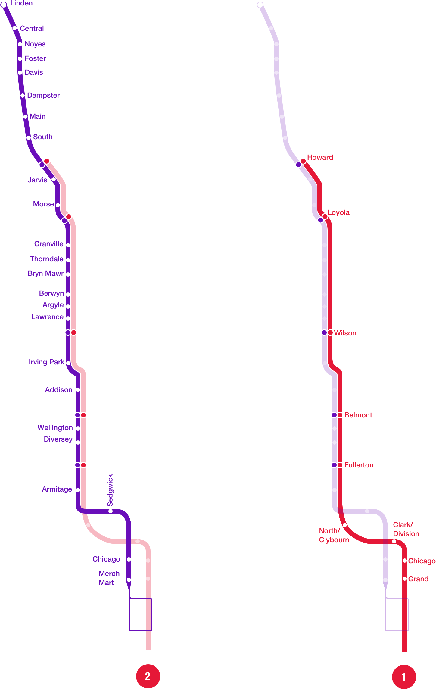
RED EXPRESS
The Purple Line as a consistent local line
and the Red Line as a true express line
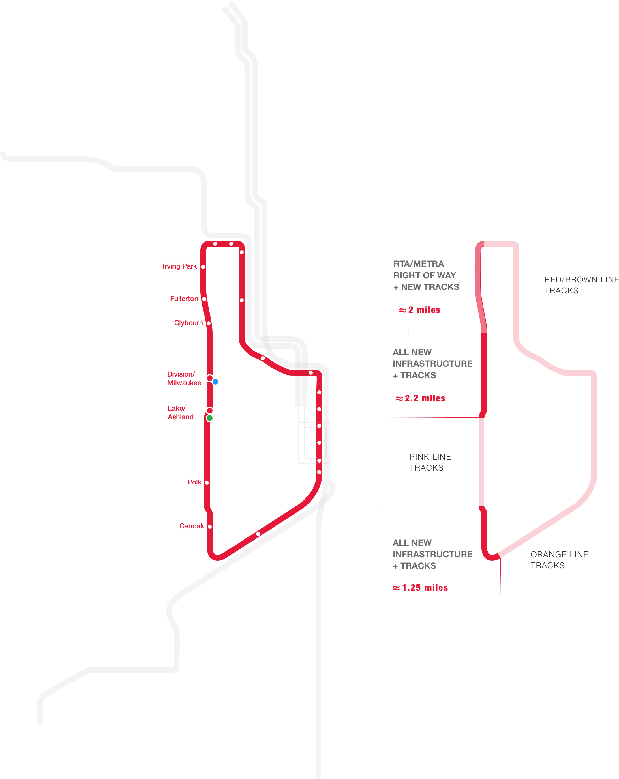
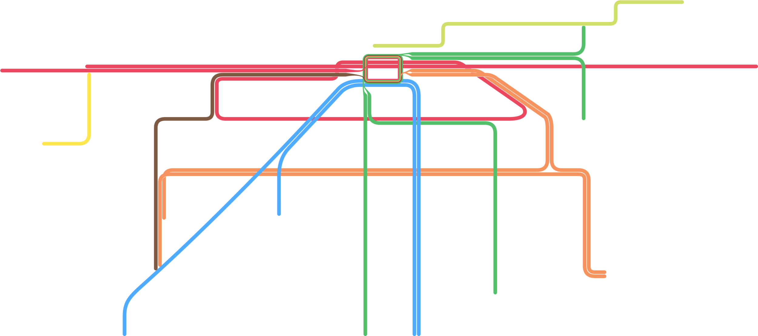
THE CIRCLE LINE
More transfers and connections
New north-south Ashland corridor
Minimal infrastructure and new stations that utilize the State street tunnel and 18th St portal

BROWN TO BLUE
Increased access between O’hare and the North Side
Improving east-west transit between Chicago’s booming Milwaukee Ave corridor and North Side neighborhoods
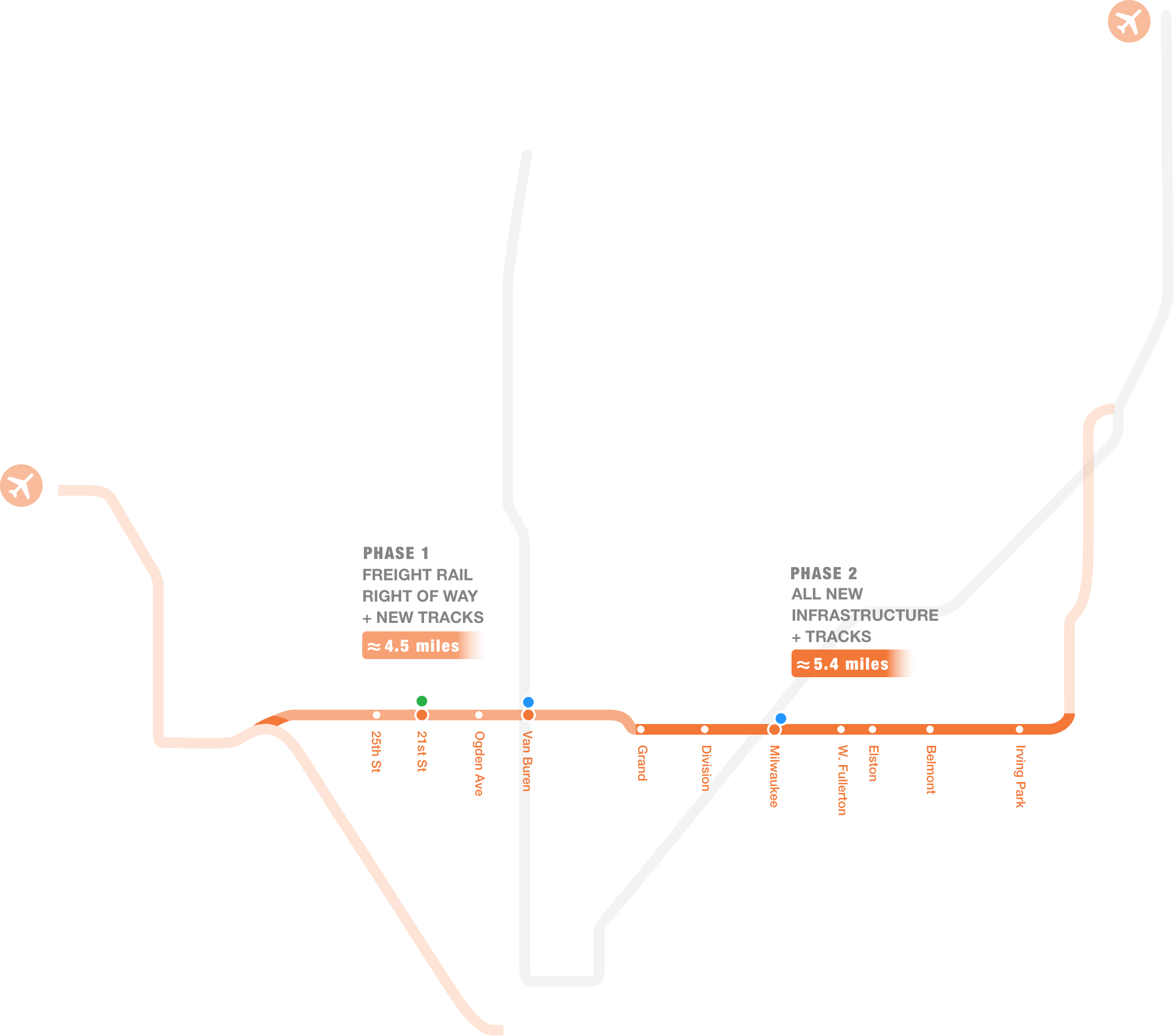
WESTERN CONNECTOR
Direct routing between O’hare and Midway
A 10-mile north-south corridor along Western Ave
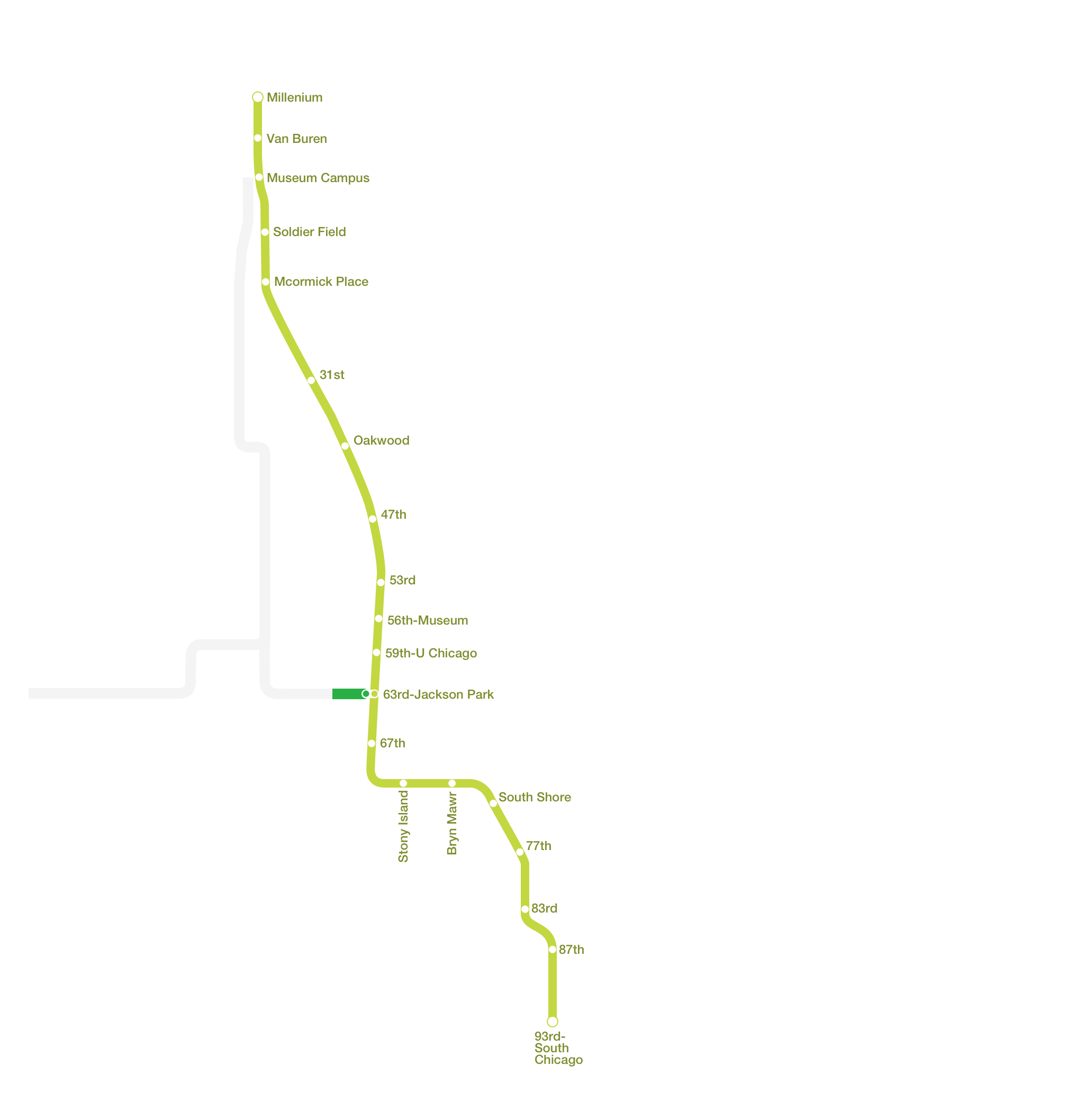
THE LIME LINE
The south side Metra Electric becomes the Lime Line
Optimizes CTA integration with a green line extension to Jackson Park, and a new transfer station at 63rd St
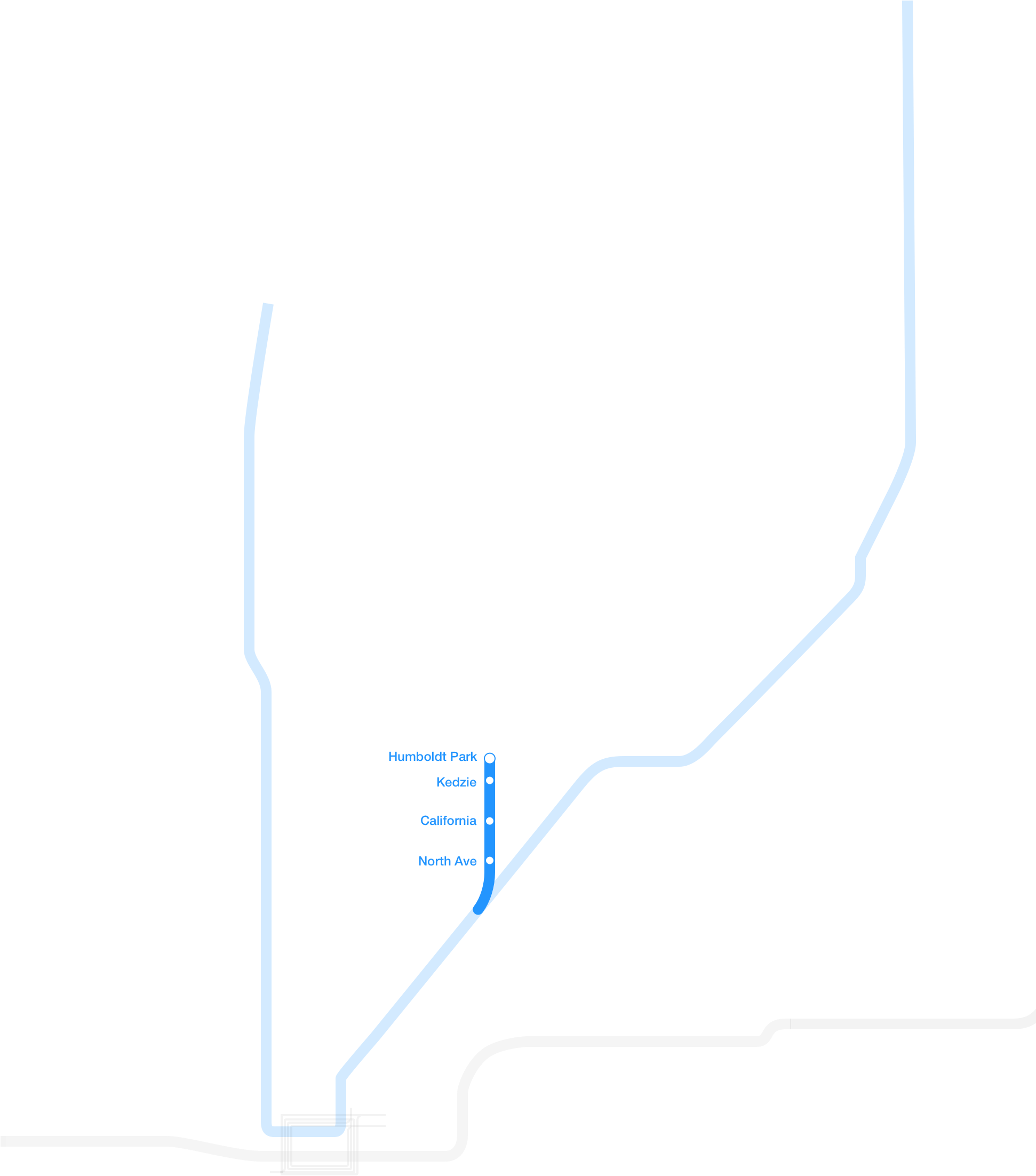
THE HUMBOLDT REVIVAL
Rebuilds the defunct CRT Humboldt Park Branch and increases east-west transit north of the Loop

More lines and route options will require new ways of thinking about route names…


